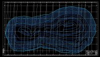
露天开采境界设计与边坡稳定性分析(含CAD图)

露天开采境界设计与边坡稳定性分析(含CAD图)(任务书,开题报告,外文翻译,论文说明书12000字,CAD图5张)
摘 要
本次设计的项目是司家营铁矿露天开采境界设计及边坡稳定性分析。设计按照国家有关规范严格设计露天矿的边坡境界,并保证矿山企业的经济效益达到最大化,并利用FLAC3D对设计完成的边坡进行边坡稳定性分析。在整个矿山各项生产活动中,对矿山项目整体经济效益影响程度最大的就是露天开采境界设计。其通过设定矿山边坡角等确定该露天矿山项目的整体矿岩量采掘数量,从而控制整体的经济效益。但是在追求矿山经济效益最大化的同时,往往会带来边坡稳定性不足的问题。本设计在设计完成的露天开采境界上,利用ANSYS建立边坡的数值模拟二维模型,并通过查询司家营矿山边坡的岩石资料,通过FLAC3D对建立的二维模型进行受力状况分析,进而得出设计边坡的稳定性状况,以综合评价矿山整体的安全状态和提出矿山边坡事故的预防措施。
关键词:露天开采境界;经济合理剥采比;数值模拟
Abstract
The design project is the boundary design and slope stability analysis of the Sijiaying iron mine. The design strictly designs the slope boundary of the open pit mine according to the relevant national regulations, and ensures the economic benefit of the mine enterprise to be maximized, and uses FLAC3D to analyze the slope stability of the designed slope. Among the various production activities of the mine, the most important impact on the overall economic benefits of the mine project is the open-pit mining boundary design. It determines the overall ore mining quantity of the open pit mine by setting the mine slope angle, etc., thereby controlling the overall economic benefits. However, while pursuing the maximization of mine economic benefits, it often brings about the problem of insufficient slope stability. In the design of the open-pit mining boundary, the ANSYS is used to establish a numerical simulation two-dimensional model of the slope, and the two-dimensional model established by FLAC3D is analyzed by the rock data of the slope of the Sijiaying mine. Furthermore, the stability status of the design slope is obtained to comprehensively evaluate the safety status of the mine as a whole and to propose preventive measures for mine slope accidents. [资料来源:Doc163.com]
Keywords: open-pit mining boundary;economic rational stripping ratio;numerical simulation
1.1项目介绍
司家营铁矿二期工程预计开采的采矿区域为Ⅰ、Ⅱ采场,其中Ⅱ采场为是一期工程开采的两个采场的其中之一。按照圈定的露天采场境界,二期工程可开发的最大矿物资源为81271万吨,按照预设计年产铁矿石1500万吨/年的标准,最多可开采54年,实际设计服役期为40年,是国有企业下的大型露天矿。二期工程配备选矿厂,能出产价值更高的精铁矿石。岩石装车采用斗容16m3的大型液压铲,利用牙轮钻机穿孔,运输利用的是载重172t TEREX MT3600B型矿用电动轮汽车。
1.2矿山工程地质概况
司家营铁矿位于河北省唐山市附近,矿区周围存在铁路干线,大型公路及河流,便于铁矿石的运输。其地理位置如下图所示:
图1.1 司家营铁矿位置图
1.2.1采矿场综合地质背景
司家营铁矿矿体为冀东矿脉的一部分,预采矿体围岩形式主要为黑云变粒岩,整体矿床属于鞍山式沉积变质矿床,本次开采主要区域在勘探线N6~N32 之间,矿体整体走向与地层走向一致,为南北走向,西倾向,倾角在45°左右。预采区域为Ⅲ号矿体及部分Ⅳ号矿体,整体构造较为均匀,从地质水平剖面图上看近似为葫芦状,并在中间薄弱处划分为Ⅰ、Ⅱ采场,两采区在地下367水平面以上相连通,其中Ⅰ采场矿体已侵入地下700m以上,Ⅱ采场矿体最大深度为580m。整个矿体有多层矿呈似层状紧密排列起来,中间部分分布夹石以区分不同小矿体。


目录
第1章 综述 1
1.1项目介绍 1
1.2矿山工程地质概况 1
1.2.1采矿场综合地质背景 1
1.2.2采矿场地层岩性 2
1.2.3矿区水文地质情况 2
[来源:http://Doc163.com]
1.3设计依据和设计准则 3
1.3.1设计依据 3
1.3.2设计准则 3
第2章 露天开采境界 4
2.1确定露天矿开采境界的原则和方法依据 4
2.1.1确定露天矿境界的主要原则如下 4
2.1.3经济合理剥采比 4
2.2露天矿开采境界要素 5
2.2.1露天矿最终边坡角的选取 5
2.2.2确定露天矿底部宽度 6
2.2.3确定露天开采境界底部位置 7
2.3确定露天矿开采深度 7
2.3.1在地质横断面图上初步拟定开采深度 7
2.3.2在地质纵断面图上调整露天矿底部标高。 9
2.4圈定露天矿开采境界的结果 10
2.4.1圈定露天开采境界的底部周界 10
2.4.2露天开采境界参数 10
2.4.3境界内矿岩量: 11
2.4.4最终边坡细部结构 12
2.5绘制露天开采终了境界图 12
第3章 露天矿边坡稳定性分析背景 14
3.1露天矿边坡特点 14
3.2矿山边坡稳定性分析方法 14
第4章 边坡稳定性分析 16
4.1边坡稳定性分析方法选择 16
4.2 FLAC3D软件介绍 16
4.3边坡稳定性系数初定 17
4.4边坡数值分析 18
4.4.1边坡数值分析模型的建立 18
4.4.2未开挖前整个岩体的位移分析 19
4.4.3开挖后边坡的应力、位移分析 20
4.4.5数值模拟结果分析 23
第5章 结语 26
参考文献 27
致谢 28 [资料来源:http://Doc163.com]
