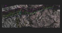
黑洛二级公路十洛段施工图设计(含CAD图)

黑洛二级公路十洛段施工图设计(含CAD图)(论文说明书19000字,CAD图10张)
摘要
黑洛公路是黑龙江省公路建设的重点项目之一,它连接了黑河市和大兴安岭地区,设计行车速度60公里/小时,采用二级公路设计标准。它的建设对完善黑龙江省内公路交通网,促进公路沿线地区经济发展,带动沿边地区早日脱贫致富,促进黑河市和大兴安岭市之间的联系,有重要意义。
本设计根据沿线地质、地形、水文等自然条件,以及黑洛公路外业勘测资料,参照交通部颁发的各种技术标准、规范,完成施工图设计。第一步是三维空间设计,其中包括:平面设计、纵断面设计、横断面设计;第二步是防护工程设计及路基路面设计。同时也给出了各部分内容相关的表格与图纸。道路路线设计对路线进行了平面设计、纵断面设计,设计是从工程建设的经济性和合理性的出发,尽量采取少填挖,减少工程量。同时也要考虑路线要与周围的自然景观相协调。道路路基路面设计主要对道路的横断面和路面的结构层进行设计和计算。道路横断面根据设计车速和交通量的要求进行设计,同时考虑了边坡的坡率取值。路面的结构层牵涉到路面材料的选取和材料强度、刚度和稳定性的验算。
关键词
路线设计 路基 沥青混凝土路面 交通量 路基 [资料来源:http://doc163.com]
Abstract
Heiluo road is one of the key project in Heilongjiang province, it connects the Heihe city and the Daxinganling city.Its design speed is 60 km/h, which adopt two-stage highway design standard. The meaning of its construction to the consummation of the road network, is promoting along the route area economy development, bringing poverty area to get rid of poverty and become rich soon, and promoting crosswise relation between the city group of the northeast of Heilongjiang Province, which is significant.
This design is based on the field operation survey data, as well as along the route natural condition including geology, terrain, hydrology and the related technical standard, which is issued by the Ministry of Transportation & Communications. According to the above we can complete the construction drawing design. First, the route three-dimensional space is designed, which include plane design, cross section design, profile design. Second shelter- design, subgrade and pavement design.At the same time, it present the reletive table and working drawing. Road routine design has made planar design and vertical section design to the routine, which starts from the economical efficiency and rationality of the engineering construction to limit filling, digging and the total engineering capacity. Meanwhile it is should considered that the routine should be coordinated with the natural resorts of the surroundings. The design of roadbed is mainly on designing and calculating the framework layer of the transect and road surface. The transect of the road is designed according to the car speed and transportation as well as the ratio of slope. The framework layer of the road also relates to the selection, intensity, freshness, stability of the road materials.
Key words
Route design,Roadbed,Asphaltic concrete pavement, transportation,subgrade
2 工程概况
黑洛公路全长740km。该公路是黑龙江省的一条重要旅游线路和沿边公路,获得了省交通厅的支持,预计总投资4.6亿元。该项目标段为二级公路施工图设计,路线全长1.8公里,该标段设计填方29281.19m3,挖方57354.59m3。
1.2.1 水文条件
路线所经区域为黑龙江水系的额木尔河和北极村河,小北沟河、老沟河是额木尔河的支流,属于封冻性河流,其径流主要靠降水(雨、雪)补给,降雨多集中在6~8月份,河道径流与降水量具有明显的季节性。地下水主要以潜水和基岩裂隙水为主,河谷平原区河漫滩覆盖着砂、砾石含水层,孔隙潜水赋存于砂、砾层中,透水性好,富水性强,补给主要为大气降水及河流;低山丘陵区地下水主要为基岩裂隙水及构造裂隙水,水量不大。
1.2.2 气候条件
路线所在地属于寒温带大陆性季风气候区,冬季气候寒冷,干燥而漫长;夏季降雨集中,雨量充沛,气候湿热,日照时间长;春、秋两季气候多变。春季多大风,降水偏少,物燥干旱,易发生森林火灾;秋季降温急剧,常有早霜和冻害发生。年平均气温在-5.5℃。各月平均气温在0℃以下的月份长达8个月之久。平均无霜期为86.2天。最大季节冻深为3.50m。全年主风向为西风和西北风,历年平均风速2.1m/s,最大风速3.6m/s。
1.2.3 地理、地形条件
该路段位于大兴安岭北麓,东经121°49′39″~122°37′01″,北纬53°15′53″~53°21′45″之间,海拔高度442~767m,属北部沿江丘陵低山地区。地貌主要以低山丘陵为主,地势起伏不平,杂草丛生,地表腐殖土很厚。生长的植被主要有针叶的落叶松、樟子松,阔叶的白桦、黑桦、杨树及一些矮小的榛材类植物。位于公路自然区划为Ⅰ1区。
[来源:http://Doc163.com]


目录
摘要 I
Abstract II
第一章 概述 1
1.1 建设项目背景 1
1.2 工程概况 1
1.2.1 水文条件 1
1.2.2 气候条件 2
1.2.3 地理、地形条件 2
[来源:http://www.doc163.com]
1.3 设计依据 2
1.4 设计标准 2
第二章 路线设计 4
2.1 选线和定线 4
2.2 平面设计 4
2.2.1 平面线形设计的一般原则 4
2.2.2 平面设计的要求 4
2.2.3 方位角的计算 5
2.2.4平曲线要素计算 5
2.2.5逐桩坐标计算 6
2.3 纵断面设计 7
2.3.1 纵坡设计的一般要求 7
2.3.2纵坡设计 9
2.3.3线形组合特征及注意问题 10
2.3.4 纵断面设计步骤 11
2.3.5高程计算 12
2.3.6竖曲线要素及变坡点处设计高程计算 12
2.3.7绘制纵断面图 13
2.4横断面设计 13
2.4.1路幅构成 13
2.4.2超高设计 14
2.5土石方的计算与调配 16
第三章 路基设计 18
3.1 概述 18
3.2一般路基设计要求 18
3.3填方路基 19
3.3.1填料选择 19
3.3.2压实度 19
3.3.3边坡 19
3.3.4地基表层处理 19
3.4挖方路基 20
3.5路基附属设施 20
3.5.1取土坑与弃土堆 20
3.5.2护坡道与碎落台 20
3.6路基稳定性验算 21
3.7挡土墙设计 21
3.7.1基本资料 21
3.7.2拟定断面尺寸 22
3.7.3主动土压力计算 22
3.7.4挡土墙抗滑稳定性验算 24
3.7.5抗倾覆稳定性验算 24
3.7.6基底应力及偏心距验算 25
3.7.7墙身截面强度验算 26
3.7.8挡土墙的变形缝设计 27
3.7.9挡土墙排水设施设计 27
第四章 路面设计 28 [资料来源:http://www.doc163.com]
4.1设计要求条件 28
4.2设计内容 28
4.2.1设计轴载 28
4.2.2轴载换算 28
4.2.3以半刚性基层层底拉应力为设计指标 30
4.3结构组成与材料选取 31
4.4设计指标的确定 31
4.4.1设计弯沉值 31
4.4.2各层材料容许拉应力 31
4.5路面结构层厚度计算 32
4.5.1确定理论弯沉系数 32
4.5.2确定设计层厚度 33
4.6沥青混凝土面层、半刚性基层和底基层层底拉应力验算 33
4.6.1 验算沥青面层底部弯拉应力 33
4.6.2 验算水泥碎石底部弯拉应力 34
4.6.3 验算石灰土底部弯拉应力 34
4.7确定路面结构层 35
第五章 排水设计 36
5.1排水的目的与意义 36
5.2排水设计原则 36
5.3路基排水设计 37
5.3.1地面排水设备 37
5.3.2地下排水设备 37
5.4路面排水设计 38
5.5路面内部排水系统设计 39
5.6路面边缘排水 39
结论 41
参考文献 42
致谢 43
[资料来源:http://Doc163.com]
